A Landscape 100 Million Years in the Making
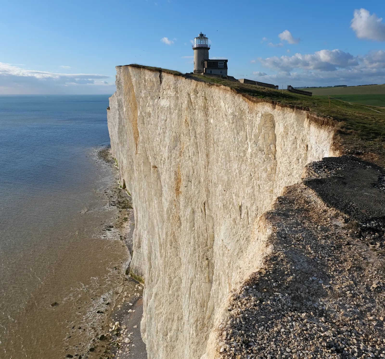
Beachy Head rises 162 metres above the English Channel, the highest chalk sea cliff in Britain. The chalk beneath Eastbourne's feet formed during the Late Cretaceous epoch, between 66 and 100 million years ago, when this land lay beneath a warm sea. Geological uplift during the Cenozoic Era raised these white strata above the waves, creating the dramatic headland visible from most of Eastbourne today.
The name itself carries French origins, appearing as "Beauchef" in records from 1274 and evolving to "Beaucheif" by 1317. It derives from the French "beau chef" meaning "beautiful headland" — the word has nothing to do with beaches, despite what many visitors assume.
How Eastbourne Saved Beachy Head
The relationship between Eastbourne and Beachy Head extends beyond mere geography. In 1929, Eastbourne Borough Council purchased 4,000 acres of land surrounding Beachy Head for £100,000 — equivalent to approximately £7.4 million in 2024. The acquisition followed the Eastbourne Corporation Act of 1926, which empowered the council to increase local taxation to fund the compulsory purchase.
This intervention saved the headland from private development, preserving it for public access. The land now forms part of the Eastbourne Downland Estate, which includes 490 hectares of open access land at Beachy Head and the Belle Tout Lighthouse area. Nearly a century later, Eastbourne residents defended this inheritance again: in 2017, public pressure halted a council proposal to sell the estate's farms.
The Two Lighthouses
Two lighthouses have guided mariners past these treacherous cliffs. The Belle Tout Lighthouse, designed by Thomas Stevenson and built between 1832 and 1834, operated until 1902. Its position on the cliff top proved problematic; fog and low clouds frequently obscured its light from vessels at sea.
In March 1999, engineers moved Belle Tout 17 metres inland using hydraulic jacks to save it from coastal erosion. The Grade II listed building now operates as a bed and breakfast following a £700,000 restoration after its purchase for £500,000 in 2008.
The Beachy Head Lighthouse, built between 1900 and 1902, replaced its predecessor. Sir Thomas Matthews designed the 33-metre granite tower, which stands at sea level where its light remains visible regardless of weather. The lighthouse received automation in 1983. Its distinctive red-and-white stripes faced removal in 2011 until a public campaign raised £27,000 for repainting, demonstrating continued local attachment to the structure.
Walking the Eastern Terminus
Beachy Head marks the eastern end of the Seven Sisters chalk cliffs and serves as the terminus of the South Downs Way, the 160-kilometre National Trail from Winchester. The trail opened in July 1972 and remains the only National Trail situated entirely within a national park.
Walkers following the South Downs Way from Hampshire arrive at Beachy Head having traversed the entire South Downs National Park, designated in 2010. The park stretches 140 kilometres and received recognition as an International Dark Sky Reserve in 2016, only the second such designation in England.
Local residents enjoy multiple walking routes across the 490 hectares of public access land, including paths from Beachy Head to East Dean and connections to Birling Gap, where a restaurant operates alongside seasonal ice cream vendors. The Beachy Head Countryside Centre provides visitor facilities for those exploring the area.
A Site of Continuous Change
The cliffs remain geologically active. Continuous erosion causes frequent small rock falls, and wave action undermines lower sections, producing slab failures. In 2001, a notable collapse destroyed a chalk formation known as the Devil's Chimney. The Seven Sisters retain their brilliant whiteness partly because this erosion continues unimpeded, unlike the White Cliffs of Dover, which are protected and have gradually greened as vegetation establishes.
Conservation and Community
The Eastbourne Downland Estate carries multiple conservation designations: Sites of Special Scientific Interest, Heritage Coast status (the first such stretch designated in Britain), Area of Outstanding Natural Beauty, and the Beachy Head West Marine Conservation Zone established in 2013. The chalk aquifer beneath provides drinking water for 700,000 people in the region.
The estate also contains 32 Scheduled Ancient Monuments, including the Neolithic Combe Hill Causewayed Camp. The "Beachy Head Lady," a Roman-era skeleton discovered in 1953 and dated to approximately 245 AD, initially puzzled archaeologists who suspected sub-Saharan origins. DNA testing in 2021 indicated southern European lineage, most likely from Cyprus.
From its geological origins to its role in Eastbourne's civic identity, Beachy Head represents both deep time and immediate community concern — a landscape that continues to define the town it overlooks.